It's with a heavy heart that the organizers of the beloved Canyon 2 Canyon Bike Ride have announced the event is being canceled indefinitely. While this news will undoubtedly disappoint our families that have joined us for the past 7 years, the city of Bryce Canyon is shifting its focus to other priorities that will ultimately benefit the local community and visitors alike. The city will now direct its attention to crucial trail upkeep and maintenance, working hand-in-hand with Bryce Canyon National Park to support the expansion of their bike paths.
In the meantime, the multi-use path remains open and free to the public from April through October, providing the perfect opportunity for families to explore the stunning scenery at their own pace and create cherished memories together.
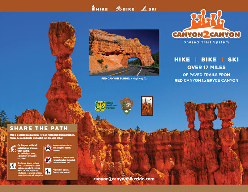
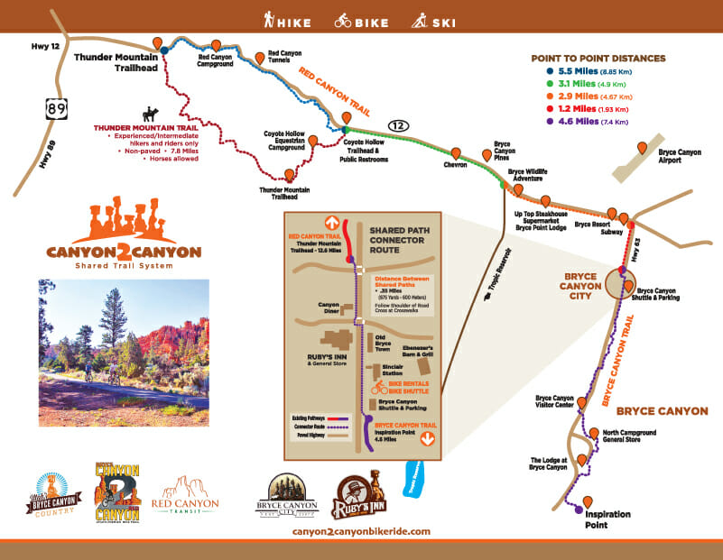
This trail is paved for the entire length and starts at the west entrance of Red Canyon. It runs for more than 6 miles past towering hoodoos and stunning red rock formations along Scenic Highway 12.
At the top of the canyon, a rest area provides restrooms and a large parking area for a break if needed. This is also where the popular Thunder Mountain Trail connects to Highway 12.
The Canyon 2 Canyon trail then continues on eastward for another 14 miles, crossing the Paunsaugunt Plateau and then turns south on Highway 63. It continues on through Bryce Canyon City and Ruby’s Inn, connecting to the new Bryce Canyon Multi-Use path.
If you are looking for an alternate option for the uphill climb, bikes are allowed on the Bryce Canyon Shuttle.
The Sinclair Station in Bryce Canyon City offers bike rentals for those who need them.
Difficulty: Easy, Intermediate
Length: approx. 20 miles
Red Canyon West Trail Head Elevation: 7,093 feet
Bryce Canyon NP Trail Head Elevation: 8,156 feet
Elevation Change: 1,117 feet
Along with biking, hiking, and running, the bike path is available for cross country skiing and snowshoeing in the winter months.